CityNeighborhoods
Central Park

Explore • Observe • Preserve
Maps • Nature • Photography
Explore • Observe • Preserve
Maps • Nature • Photography
Central Park is the crown jewel of New York City real estate. Sitting at the heart of the island of Manhattan, Central Park was designed - yes designed - to be a balance: a counterweight to the relentless progress beyond its borders. And while the story of New York City and its architecture is (quite rightly) is told through the streets, concrete, steel and glass of its towering skyscrapers, the story of Central Park - and its own architecture - is no less compelling.
I have been visiting and photographing Central Park for over a decade - through all fours seasons, through all kinds of weather: from steamy summer to the fresh-fallen snows of winter; from the pastel mists of spring; to the windswept kaleidoscopes of autumn. What has stayed with me is the realization that Central Park is much more like the urban grids of NYC than you may realize. It is its own city, with its own boroughs and, most importantly … its own neighborhoods. All of that stems from one immutable reality:
Central Park is designed, with purpose.
CityNeighborhoods NYC organizes that design into five regions, over 40 neighborhoods. For the first time ever, explore Central Park as never before - through photos, history, maps and lore - and discover how Central Park symbolizes the ever-present dichotomy of of progress and struggle that have defined the greatness of New York City.
The Maps
Geographic Setting
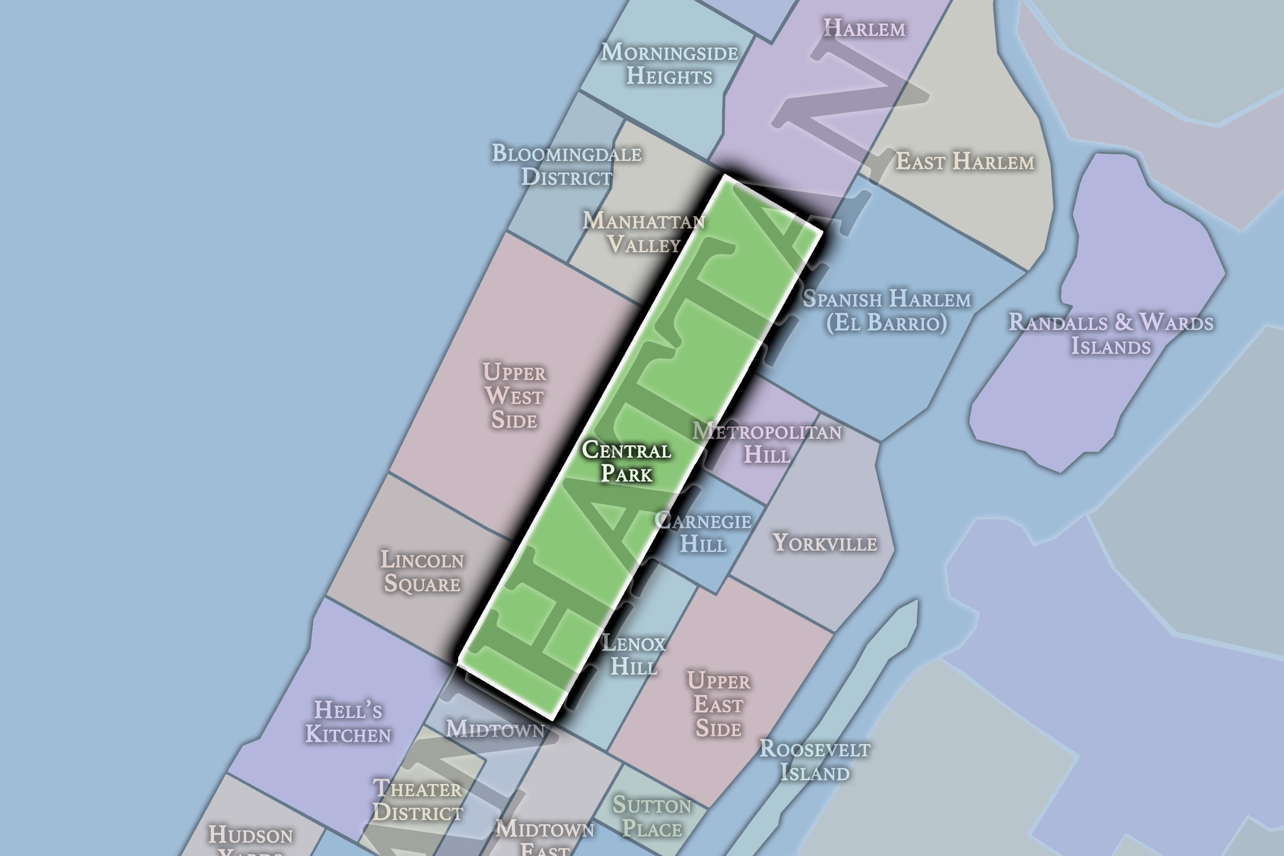
Central Park occupies a long, rectangular swath of central Manhattan, extending from 59th Street at Central Park South to 110th Street at Central Park North. Fifth Avenue forms its eastern edge, while Central Park West forms its western edge, placing the Park between the Upper East Side and Upper West Side while also meeting Harlem at its northern boundary. Across 843 acres, it creates a continuous green landscape within one of the world’s densest urban environments.
Its north–south length gives Central Park an unusual internal geography. The southern entrances are shaped by major gateways, institutions, formal landscapes, and the immediate presence of Midtown’s skyline. Farther north, the Park opens into lakes, woodlands, overlooks, meadows, athletic fields, the Reservoir, and the more rugged landscapes of North Woods. Though often experienced as a single destination, Central Park changes substantially from block to block, with each section carrying its own terrain, rhythm, landmarks, and relationship to the surrounding city.
CityNeighborhoods Central Park organizes this landscape into five directional regions: the South End, Mid-Park South, Mid-Park, Mid-Park North, and North End. These regions follow the Park’s progression from 59th to 110th Street, creating a practical framework for understanding its many neighborhoods, landscapes, landmarks, and connective systems. They do not replace the Park’s official geography; they provide a way to see how its distinct places relate to one another across its full length.
Central Park Identity
Etymology and Origins
Central Park’s name is direct, but its meaning is expansive. Conceived in the nineteenth century as a great public landscape at the center of a rapidly growing Manhattan, the Park was intended to offer room for movement, recreation, reflection, and shared civic life within an increasingly crowded city. Its centrality was not merely geographic. From the beginning, Central Park was imagined as a common ground: a place whose value would be measured not only by beauty, but by public access.
Yet the Park did not emerge from empty land. Before Central Park, this section of Manhattan held farms, roads, rocky outcrops, wetlands, institutions, and established communities. Most consequentially, the future Park encompassed Seneca Village, a predominantly Black community whose residents built homes, churches, schools, property ownership, and local life on the high ground west of today’s Great Lawn. The creation of Central Park displaced Seneca Village and other residents, leaving a history that remains essential to understanding the landscape beneath the Park.
Central Park therefore begins with a contradiction that still shapes its meaning. It is one of New York’s greatest public gifts, but it was also created through political power, land acquisition, removal, and transformation. To understand the Park is to see both sides: the democratic ambition of a shared urban landscape and the communities, histories, and physical ground altered in order to produce it.
Design, Purpose & Physical Framework
Central Park was designed not simply as scenery, but as a public experience. Frederick Law Olmsted and Calvert Vaux’s Greensward Plan proposed a landscape where New Yorkers from different backgrounds could move through meadows, woods, water, gardens, drives, and promenades without the city’s ordinary pressures dominating every view. Its pastoral landscapes offered openness and repose; its picturesque woods, rocks, and watercourses invited wandering, concealment, and discovery; its formal terraces and promenades created places for gathering and civic display.
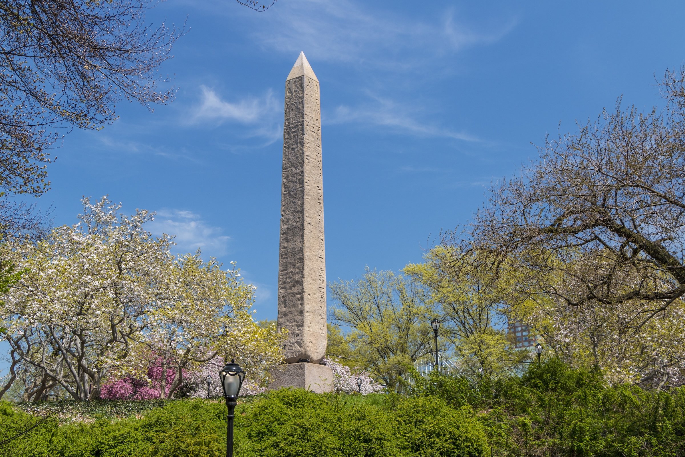
The Park’s apparent naturalness is among its most carefully constructed achievements. Bedrock was cut and reshaped, soil was imported, water bodies were formed, hills were graded, and thousands of trees and shrubs were planted. The result was not untouched wilderness, but an urban landscape engineered to feel larger, deeper, and more varied than its Manhattan setting might suggest. Central Park’s geology remains visible throughout the design, especially at its exposed rock formations, ridges, ravines, overlooks, and woodland interiors.
Movement through the Park was designed with equal care. Pedestrian paths, carriage drives, bridle routes, bridges, arches, and sunken transverse roads separate different kinds of circulation while allowing them to coexist. A visitor can pass beneath a bridge, emerge beside a meadow, cross above hidden traffic, descend toward water, or climb onto bedrock without fully seeing the systems that make those transitions possible. This vertical choreography is one of Central Park’s defining ideas: the landscape does not merely contain movement; it directs, conceals, and reveals it.
Central Park & New York
Central Park is both a refuge from New York and one of the clearest places to understand New York itself. Its lawns, woods, water, and paths offer relief from Manhattan’s density, yet the city is never fully absent. Skyscrapers rise beyond Sheep Meadow and the Reservoir; museum façades, apartment towers, traffic corridors, and neighborhood edges frame the Park from every side. Central Park is a landscape apart from the city, but also a stage on which the city remains visible.
That relationship gives the Park an unusual civic role. It is a public commons surrounded by some of the country’s greatest concentrations of wealth, culture, real estate, and institutional power. On any given day, its spaces are shared by runners, school groups, musicians, birders, families, tourists, workers on lunch breaks, longtime New Yorkers, and people simply looking for a place to sit beneath a tree. The Park does not erase New York’s inequalities, but it creates one of the city’s rare settings in which radically different lives can occupy the same landscape.
Other New York parks hold their own histories, communities, and forms of beauty. Central Park is distinct because of its location in the center of Manhattan, the completeness of its nineteenth-century design, its extraordinary concentration of landmarks and landscapes, and its unusual symbolic reach. It is at once a neighborhood resource, a destination for the entire city, a national landmark, and a global image of New York. Its scale is not only measured in acres; it is measured in the depth of its presence within the city’s imagination.
Cultural Life & Public Imagination
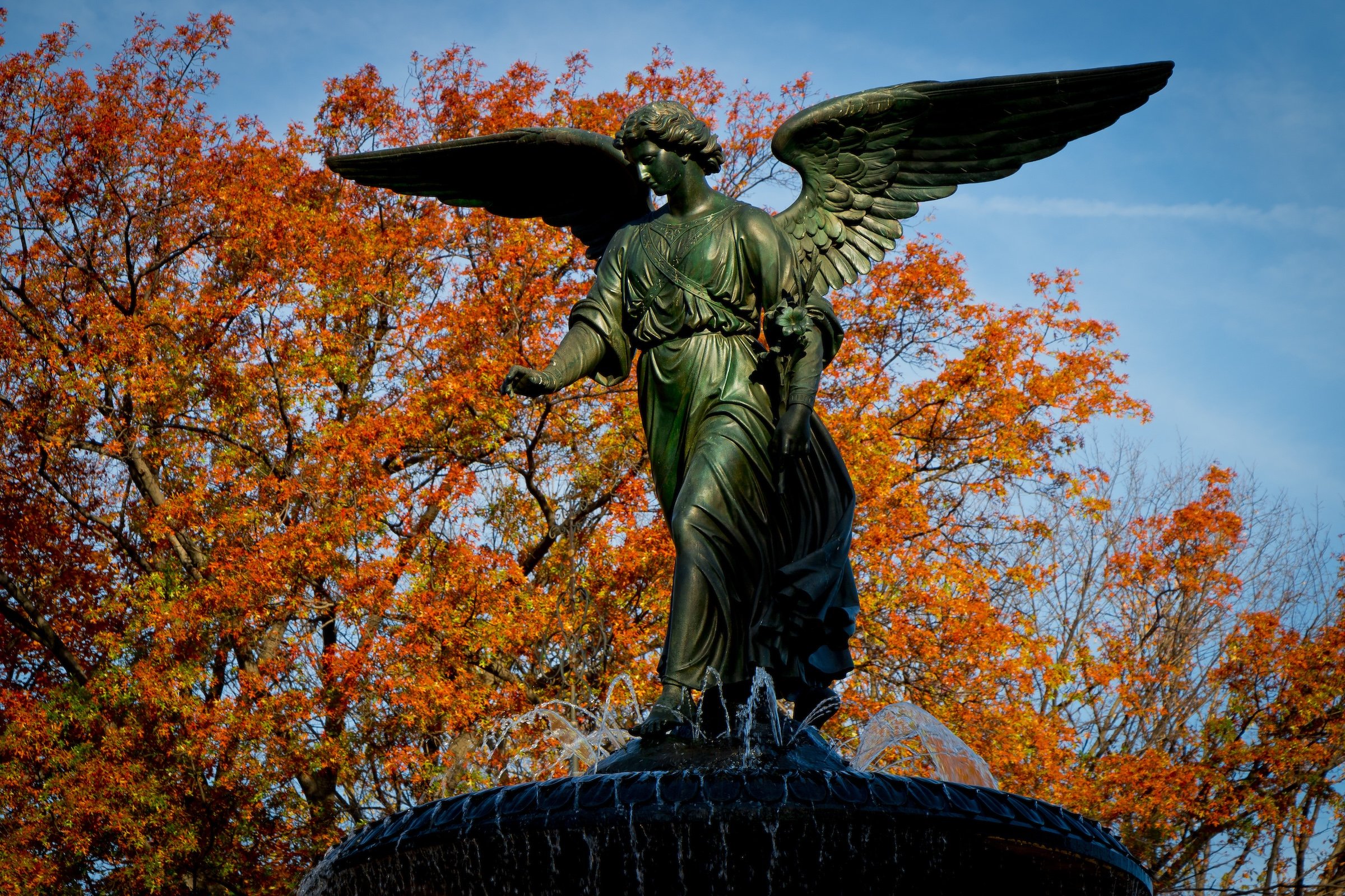
Central Park has long been more than a place to visit. It is one of New York’s great cultural settings: a place for concerts, theater, memorials, celebration, protest, ritual, recreation, and everyday urban life. The Mall and Bethesda Terrace function as civic stages; the Great Lawn and Sheep Meadow become vast gathering grounds; the Delacorte Theater carries the tradition of free Shakespeare in the Park; and the Park’s paths, bridges, lawns, and overlooks continue to shape how New Yorkers meet, perform, and remember.
Music and memory are woven deeply into the Park’s landscape. Simon & Garfunkel’s 1981 reunion concert on the Great Lawn remains one of its defining public spectacles. Strawberry Fields, created in memory of John Lennon near the Dakota, has become a place of tribute, pilgrimage, music, and quiet reflection. Across the Park, monuments, named landscapes, fountains, gates, and gathering places preserve stories that range from literature and art to civil rights, activism, public service, and personal loss.
Central Park has also become inseparable from the visual language of New York. It appears in film, television, photography, literature, painting, and popular memory not simply because it is recognizable, but because it can become so many things at once: romance, solitude, childhood, glamour, wilderness, danger, public joy, and escape. Its familiar places are continually remade by the people who pass through them. The Park remains a designed work of landscape architecture, but it is also a living cultural archive—one renewed every day by the city around it.
The Five Regions
-
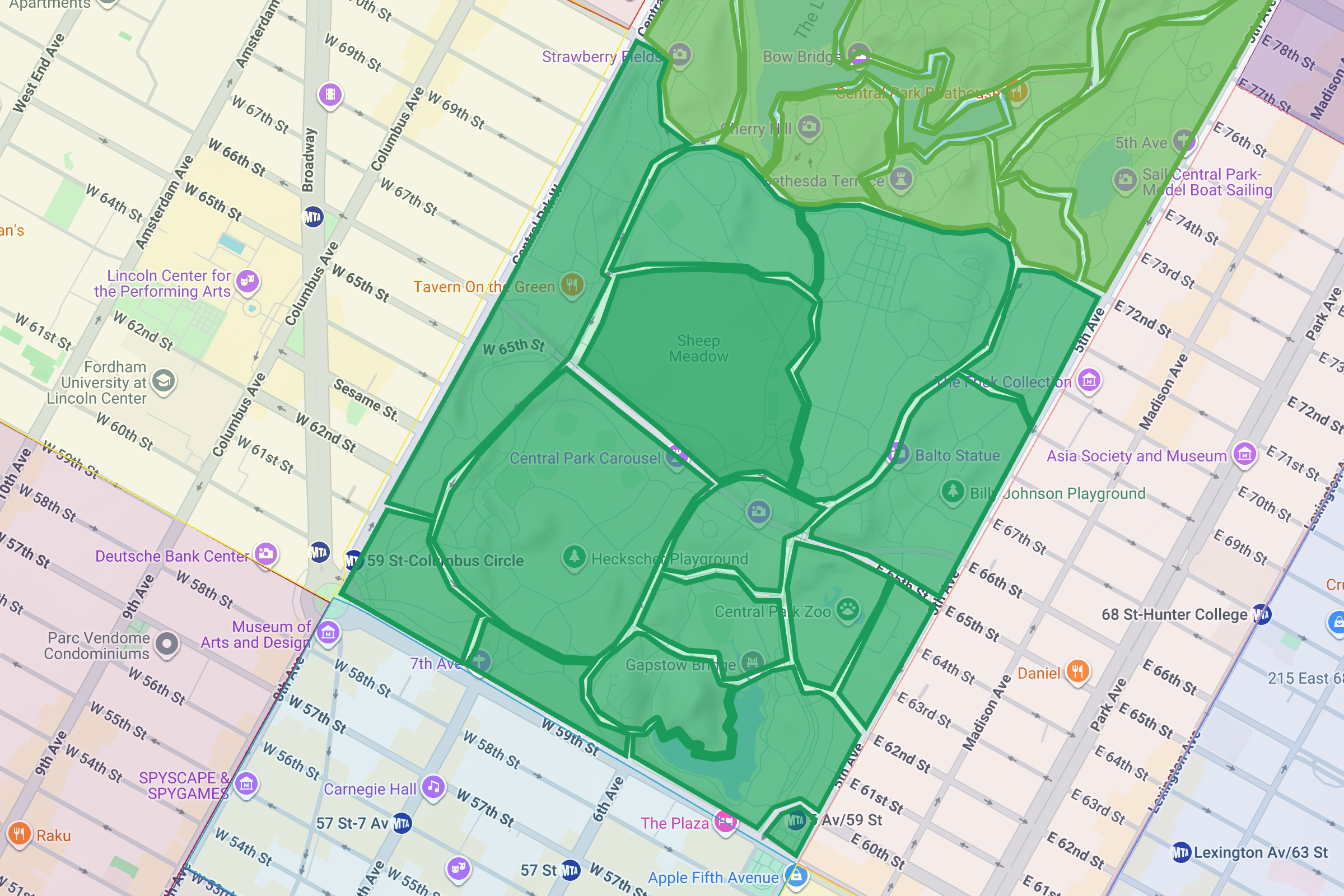
The Southern Gateway
From 59th - 72nd Streets; includes The Central Park Zoo, The Pond, Sheep Meadow, The Mall, and Tavern on the Green.
-
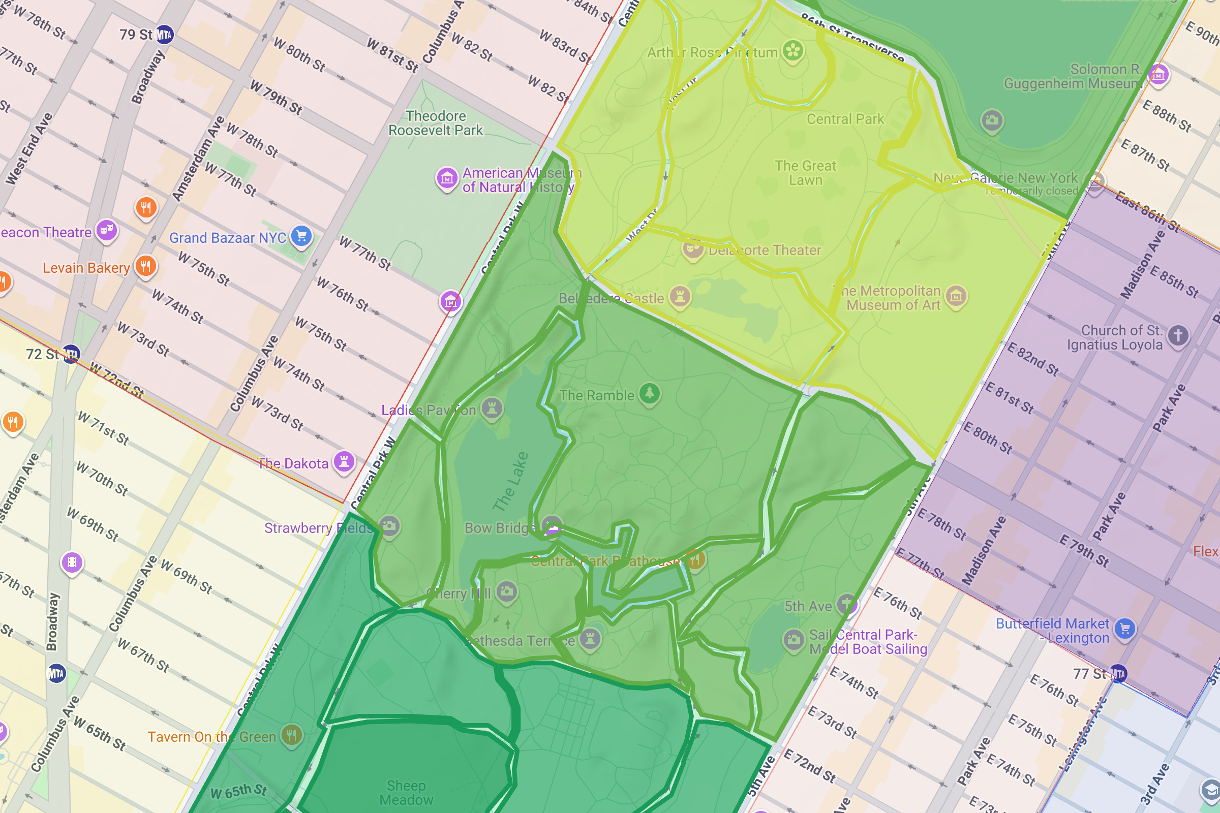
The Landmarks
From 72nd - 79th Streets; includes: The Lake, Cherry Hill, Bethesda Terrace, Conservatory Water, Strawberry Fields, and The Ramble.
-
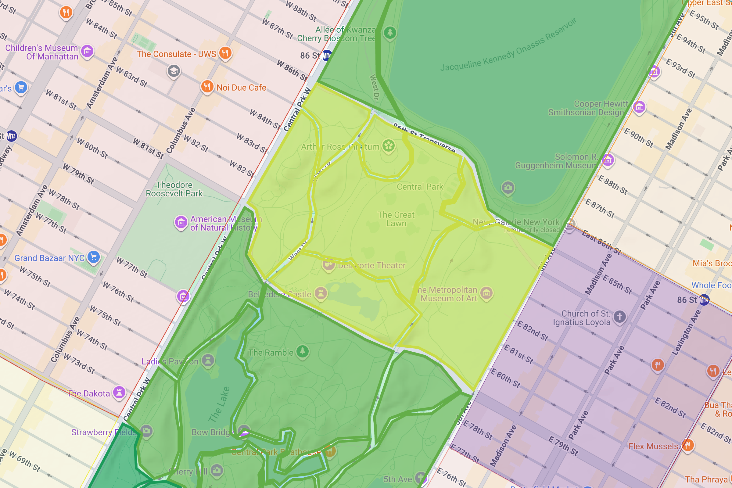
The Heart
From 79th - 86th Streets; includes Belvedere Castle, Turtle Pond, The Great Lawn, Seneca Village, and The Metropolitan Museum of Art.
-
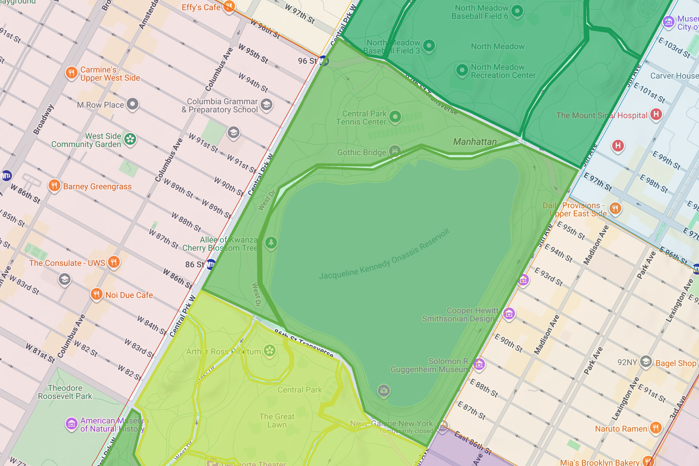
The Reflections
From 86th - 97th Streets; includes the Jacqueline Kennedy Onassis Reservoir and West Meadow.
-
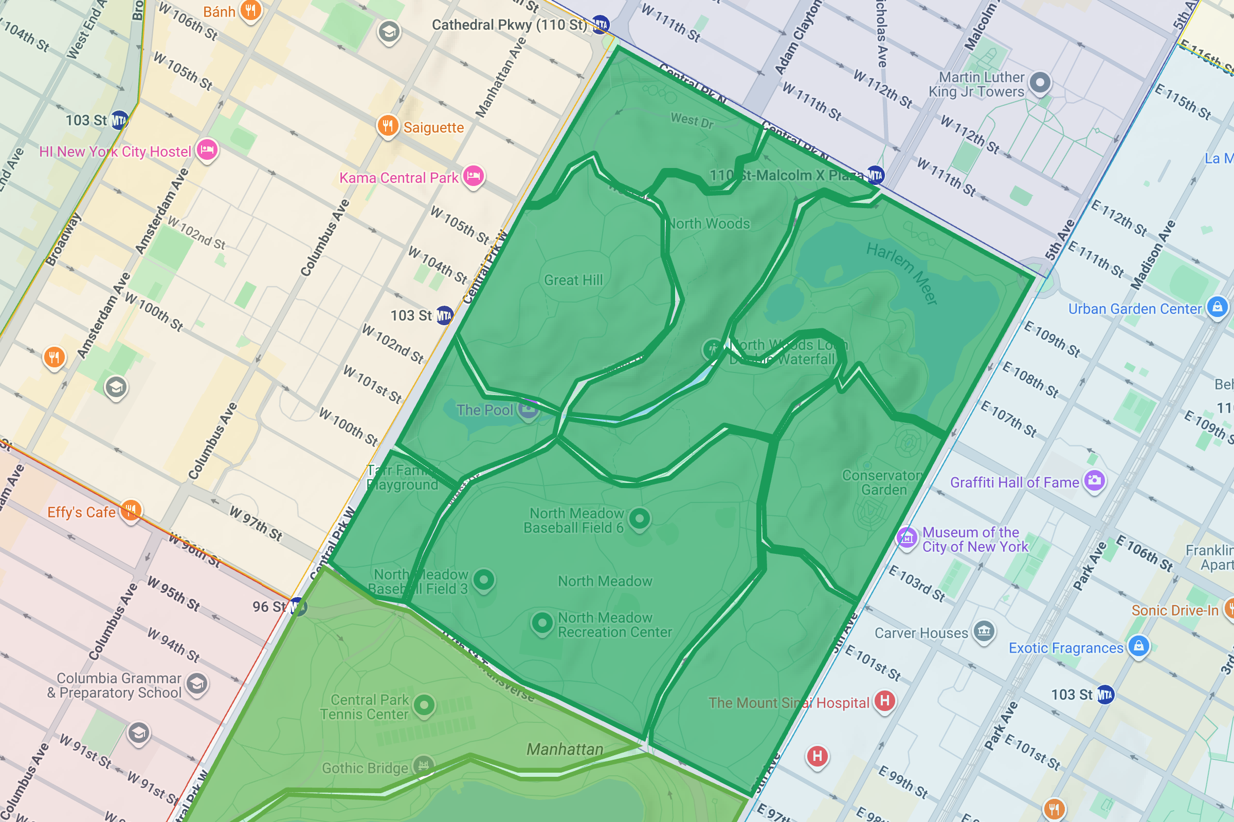
The Northern Capstone
From 97th - 110th Streets; includes: the Meadows, The Pool & Loch, Harlem Meer, The Great Hill, North Woods, and Conservatory Garden.
South End
From 59th to 72nd Streets, the South End is Central Park’s threshold: the place where Midtown, Columbus Circle, Fifth Avenue, and the Park’s first great landscapes meet. It is the region of arrivals, first impressions, and immediate contrast. The Pond, the Zoo, Sheep Meadow, Tavern on the Green, and the Mall each offer a different way into the Park, but all share the same essential tension: the density and spectacle of Manhattan pressing close against a deliberately composed landscape of lawns, water, paths, and trees.
This is also the Park at its most public and kinetic. Visitors move through gateways and gathering places, children and families fill the Zoo and playgrounds, and Sheep Meadow opens toward one of the city’s most dramatic skyline horizons. The South End is not simply the beginning of Central Park geographically. It is the place where the Park makes its first argument for itself: that a common landscape can interrupt the city’s intensity without ever fully leaving the city behind.
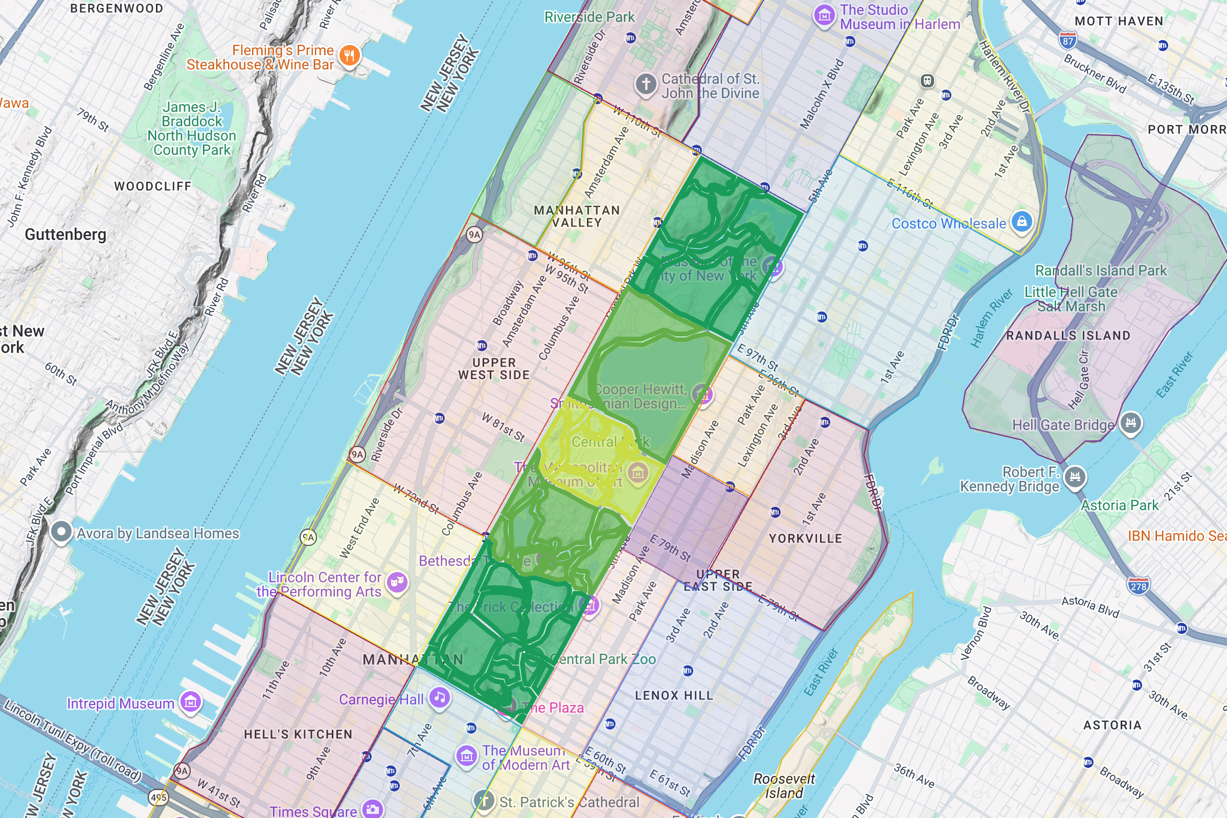
Mid-Park South
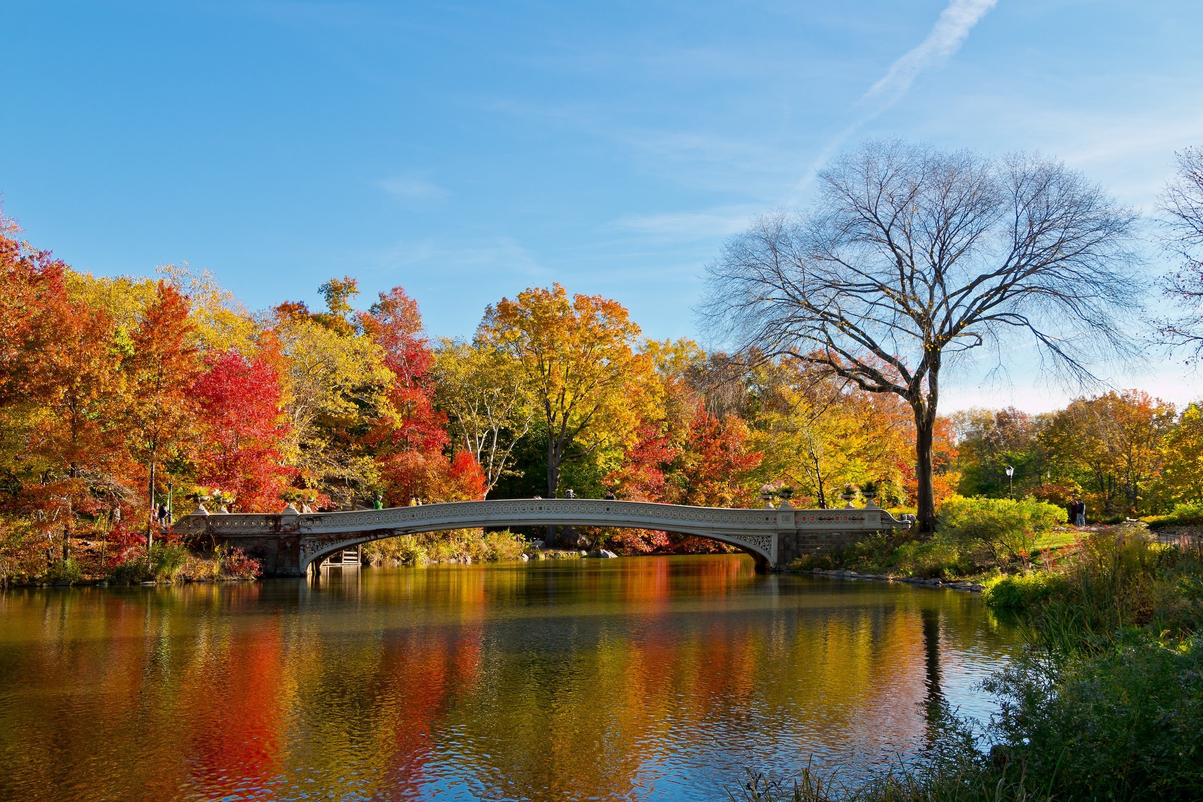
From 72nd to 79th Streets, Mid-Park South gathers some of Central Park’s most celebrated landscapes into a remarkably dense sequence. The Lake, Cherry Hill, Bethesda Terrace, Conservatory Water, Strawberry Fields, and the Ramble each have their own identity, yet together they create one of the Park’s most complete expressions of scenery, architecture, memory, and public life. This is where formal promenade gives way to water, woodland, overlooks, and some of the most photographed views in New York.
The region’s landmarks are not isolated attractions. Bethesda Terrace looks toward the Lake and the Ramble; Cherry Hill and Bow Bridge frame water and skyline; Strawberry Fields joins remembrance to everyday gathering; Conservatory Water offers a quieter, more intimate landscape nearby. Mid-Park South is therefore the Park at its most concentrated and cinematic: a place where every turn seems to reveal a familiar image, while the spaces between those images create a much richer experience of movement, transition, and discovery.
Mid-Park
From 79th to 86th Streets, Mid-Park forms the geographic and symbolic heart of Central Park. Belvedere Castle, Turtle Pond, the Great Lawn, Shakespeare Garden, the Delacorte Theater, Seneca Village, and the Metropolitan Museum of Art all converge here, creating an unusually layered landscape of culture, memory, geology, recreation, and design. The area feels central not only because of its position within the Park, but because so many of Central Park’s defining ideas meet within it.
This is a region shaped by high ground and deep history. Vista Rock and the Belvedere rise above Turtle Pond and the Great Lawn, while the former site of Seneca Village reminds visitors that the Park’s creation transformed an already inhabited landscape. To the east, the Metropolitan Museum forms one of the Park’s most important civic edges; to the west, paths and bedrock lead toward quieter terrain. Mid-Park is where Central Park becomes most visibly a city within the city: a place where public culture, engineered landscape, institutional power, and historical memory occupy the same ground.
Mid-Park North
From 86th to 97th Streets, Mid-Park North opens outward. The Jacqueline Kennedy Onassis Reservoir dominates the region, creating a broad interval of water, sky, movement, and skyline views unlike anywhere else in the Park. Its encircling path turns walking into a continuous act of observation, with the city appearing differently from each side of the water. Nearby, West Meadow provides a quieter land-based counterpart: an open, less monumental landscape that helps define the region’s spacious character.
The Reflections is not organized around a dense collection of major attractions. Its identity comes from scale, rhythm, and pause. The Reservoir slows the visitor down; the meadow, paths, courts, and wooded edges create room between the more tightly composed landscapes to the south and the wilder northern terrain beyond 97th Street. Mid-Park North is therefore one of the Park’s most contemplative regions—a place where the city becomes panorama, water becomes mirror, and Central Park’s carefully constructed sense of openness is at its most expansive.
North End
From 97th to 110th Streets, the North End brings Central Park to a powerful conclusion. The Meadows, the Pool and Loch, Harlem Meer, Great Hill, North Woods, and Conservatory Garden create the Park’s most varied final landscape: open recreation fields, formal gardens, woodland ravines, watercourses, high ground, and Harlem-facing civic space. It feels less like a continuation of the Park’s southern image than a distinct world with its own topography, pace, and relationship to the surrounding city.
Here, Central Park becomes more rugged, ecological, and regionally connected. The North Woods and Ravine reveal the Park’s most immersive woodland experience; the Loch carries water through a landscape of rock, bridges, and changing elevation; Harlem Meer opens the Park toward the neighborhoods to its north and east. Yet the North End also contains the formal precision of Conservatory Garden and the open civic ground of North Meadow and Great Hill. As the Northern Capstone, it gathers the Park’s major themes—nature, design, recreation, memory, public life, and change—into its most expansive and varied final chapter.
The History
Origins - The Lenape
Long before Central Park, this land formed part of the ancestral homeland of the Lenape people. Its exposed rock, wetlands, wooded slopes, and ridges belonged to a larger Indigenous landscape shaped by seasonal movement, ecological knowledge, and long-standing routes across Manahatta—the island of many hills. The rocky northern terrain, including the passage later known as McGowan’s Pass, followed paths used for generations before European settlement.
Central Park still preserves unusual traces of that earlier terrain. Bedrock rises through lawns and woodlands; glacially shaped slopes remain visible at Summit Rock, Vista Rock, the Ravine, and throughout the North Woods. These formations are not merely scenic details. They are remnants of a landscape that existed long before the Park’s engineered meadows, lakes, paths, and monuments.
The Lenape story is not solely a prehistory of the Park. Descendant communities continue to sustain relationships with this ancestral homeland, while contemporary research and interpretation increasingly acknowledge the Indigenous history beneath Central Park’s designed landscape.
Colonial New York: 17th-18th Centuries
European colonization transformed the land through ownership, farming, roads, and military strategy. Dutch and later English settlers established farms and taverns near the northern reaches of what would become the Park, while much of the rocky, swampy terrain farther south remained sparsely settled and was dismissed by colonial authorities as marginal or unproductive land.
The northern landscape became a strategic passage between the growing city and Harlem. A route that followed an earlier Indigenous trail developed into Kingsbridge Road and later the Post Road, crossing the high ground near McGowan’s Pass. Its ridges and distant views made the area militarily significant during both the Revolutionary War and the War of 1812.
The Blockhouse, built in 1814 near today’s North Woods, survives as the Park’s clearest physical connection to this era. It is a reminder that Central Park’s present landscape contains not only pastoral scenery, but traces of roads, farms, fortifications, and contested ground that long predated the Greensward Plan.
Early America - 1800-1853
By the early nineteenth century, Manhattan was expanding rapidly, but the future Park remained a varied and inhabited fringe landscape. Farms, reservoirs, roads, religious institutions, small industries, and working-class settlements occupied land that later generations would mistakenly imagine as empty wilderness. The area included rocky uplands, marshy ground, modest homes, and communities shaped by race, class, immigration, and uneven access to land.
Seneca Village became the most significant of these communities. Founded in 1825 by free Black New Yorkers purchasing property north of the developed city, it grew into a predominantly Black neighborhood with churches, a school, burial grounds, and substantial rates of homeownership. Irish and German residents also lived there, creating a community whose social and civic importance has only recently begun to receive the attention it deserves.
At the same time, New York’s density, crowding, and public-health concerns helped generate demand for a large public landscape. Advocates imagined a park that could provide fresh air, recreation, scenery, and civic prestige. The proposed solution would transform Manhattan’s geography—but it would also displace the people already living upon it.
Planning The Park - 1853-1858
In 1853, New York State authorized the acquisition of land for a major public park. The project was presented as a democratic civic investment: a place where New Yorkers could encounter nature, recreation, and one another beyond the pressures of the built city. Yet the creation of that public good depended on eminent domain, removal, and the restructuring of an already inhabited landscape.
The City acquired farms, homes, institutions, burial grounds, and settlements across the site. Seneca Village residents were displaced in 1857, alongside Irish, German, and other residents whose histories were often less fully recorded. Property owners received compensation, but renters, laborers, and those without formal ownership faced a more precarious loss. The Park’s founding therefore joined democratic aspiration to an unequal exercise of public power.
A design competition in 1857–58 sought to determine what this new park would become. Frederick Law Olmsted and Calvert Vaux’s Greensward Plan won because it combined formal civic spaces, naturalistic scenery, architecture, water, and carefully separated circulation. Their proposal did not preserve the existing landscape unchanged; it imagined an entirely new public world built from its terrain.
Building The Park - 1858-1873
Central Park’s apparent naturalness was constructed through an immense feat of labor and engineering. Workers excavated and reshaped rock, drained marshes, brought in soil, planted trees, formed lakes and meadows, and created an elaborate network of paths, drives, bridges, arches, and transverse roads. The Park was built by hand at a scale that transformed rough, uneven land into a composed landscape of remarkable variety.
Olmsted and Vaux designed the Park as an experience of movement. A visitor might pass from formal promenade to woodland path, from open meadow to water’s edge, from high bedrock to sunken roadway, often without seeing the infrastructure that made those transitions possible. The transverse roads, carried below grade, allowed crosstown traffic to cross the Park while protecting the illusion of uninterrupted landscape.
The first sections opened to the public even as construction continued. The Lake became an early winter attraction in 1858, and the Park developed over the following fifteen years into the landscape largely recognizable today. Its woodlands, water bodies, terraces, bridges, and open lawns were not remnants of countryside preserved in Manhattan; they were a new kind of urban nature deliberately made for public life.
The Early Years - 1873-1900
By the late nineteenth century, Central Park had become one of New York’s defining public places. Carriage drives, promenades, boating, skating, concerts, children’s recreation, and seasonal gatherings made the Park a destination for residents and visitors alike. Its landscapes became part of the city’s social rituals, offering both spectacle and respite within an increasingly dense metropolis.
The Park’s democratic ideal was real, but imperfectly realized. It invited a broad public into a shared landscape while also reflecting the era’s expectations around class, gender, behavior, and respectable leisure. The Mall, Bethesda Terrace, and carriage drives could serve as civic spaces, but they also became stages for seeing and being seen.
Even in its early success, Central Park required constant care. Its planted landscapes, water systems, paths, structures, and lawns could not simply be left alone. The long history of the Park would repeatedly show that its beauty depended on stewardship—and that neglect could quickly alter both its physical condition and public meaning.
Early 20th Century
By the early twentieth century, Central Park was adapting to a city whose recreation patterns had changed. Formal promenades and carriage culture no longer defined public life as they once had, while active recreation, children’s play, museums, organized sports, and new forms of leisure became more prominent. The Park’s role shifted from a nineteenth-century landscape retreat toward a more varied civic resource.
This era also brought signs of deterioration. Plantings were not consistently renewed, soil eroded, and paths and watercourses suffered from uneven maintenance. At the same time, the Park continued to acquire new uses and features, including Heckscher Playground in 1926 and the Conservatory Garden in the 1930s, both reflecting changing ideas about childhood, recreation, and public landscape.
Central Park entered the modern era carrying a tension that would remain central to its identity: how could a historic designed landscape accommodate the needs of a growing, changing city without losing the qualities that made it exceptional?
Mid-Late 20th Century
The appointment of Robert Moses as Parks Commissioner in 1934 brought a major period of intervention. Federal funding and a more aggressive public-works approach introduced playgrounds, ballfields, courts, Wollman Rink, and other recreational facilities. These changes made Central Park more active and accessible to many New Yorkers, while also altering aspects of the original Olmsted and Vaux landscape.
After Moses’s departure in 1960, Central Park entered a long period of underfunding, declining maintenance, and public anxiety. By the 1970s, eroded lawns, failing infrastructure, broken furnishings, litter, graffiti, and a widespread sense of insecurity had transformed the Park’s reputation. Yet this period also produced new cultural meanings: performance, protest, gathering, music, recreation, and neighborhood use continued to make the Park a vital public stage.
Preservation became a turning point. Central Park was named a National Historic Landmark in 1965 and a New York City scenic landmark in 1973. In 1980, the Central Park Conservancy formed in partnership with the City, beginning a sustained restoration and management model that would reshape the Park’s future.
21st Century
In the twenty-first century, Central Park has become an ongoing project of restoration, ecological care, accessibility, and public stewardship. Historic structures, bridges, woodlands, water bodies, playgrounds, paths, monuments, and landscapes have been repaired or renewed while the Park continues to serve millions of visitors each year. Restoration has increasingly treated the Park as both a cultural landmark and a living ecological system.
The Park’s northern landscapes have received particular attention, reconnecting the Ravine, Loch, Harlem Meer, and surrounding woodland systems while strengthening ties to Harlem and the communities bordering the Park. The Davis Center at the Harlem Meer represents this newer approach: landscape restoration, recreation, community programming, water management, and year-round public use brought together in one project.
Central Park also continues to reassess its own history. Seneca Village has become more visible through archaeological research, interpretation, and plans for permanent commemoration. Newer memorial and entrance projects, including the Gate of the Exonerated, reflect a broader effort to recognize histories and communities that earlier versions of the Park overlooked.
Spirit & Legacy
Central Park endures because it is more than a park. It is an artwork of landscape architecture, a civic commons, a historic site, an ecological habitat, a cultural stage, and a daily refuge. It can feel intimate or monumental, carefully composed or unexpectedly wild, depending on where and how one enters it.
Its legacy is inseparable from contradiction. The Park represents democratic leisure and public beauty, but also displacement and uneven power. It offers escape from Manhattan while framing the city’s wealth, density, ambition, and inequality at every edge. It preserves rocks, water, woods, and paths that seem timeless, even though nearly every part of the landscape has been designed, altered, restored, or reimagined.
To walk Central Park is to move through many layers at once: Lenape landscape, colonial passage, pre-park settlement, nineteenth-century engineering, civic ritual, cultural memory, ecological renewal, and everyday New York life. Its lasting power comes not from standing outside the city, but from continually revealing what the city has been—and what it still hopes to become.
The Photography
Visual Identity
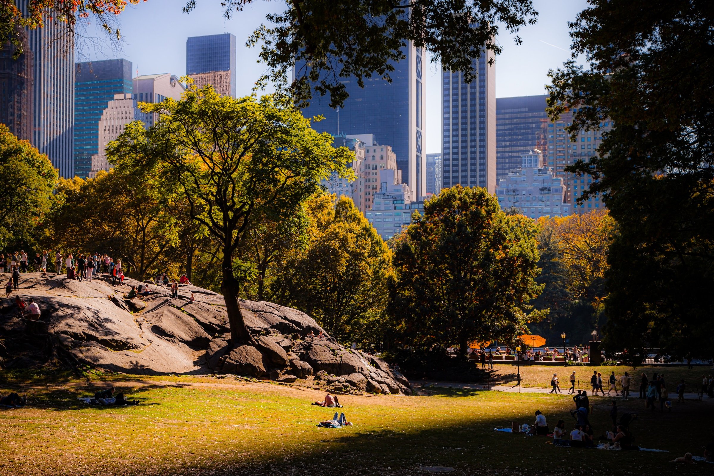
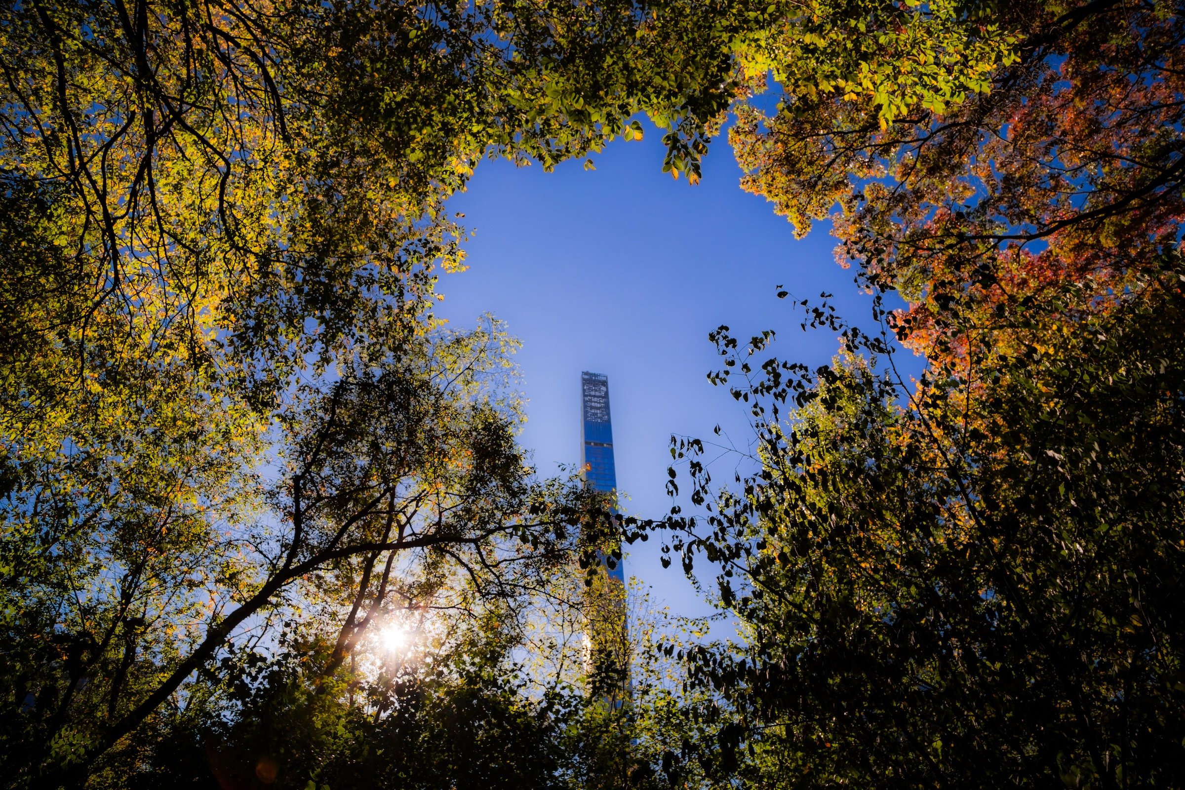
Central Park has no single visual identity. It moves between open meadow and enclosed woodland, exposed bedrock and carefully planted garden, reflective water and hard-edged skyline. Its paths can narrow into shade beneath old trees, then open suddenly toward towers, lakes, monuments, or a broad field filled with people. The Park’s character is made from those transitions: the designed discovery of one landscape giving way to another.
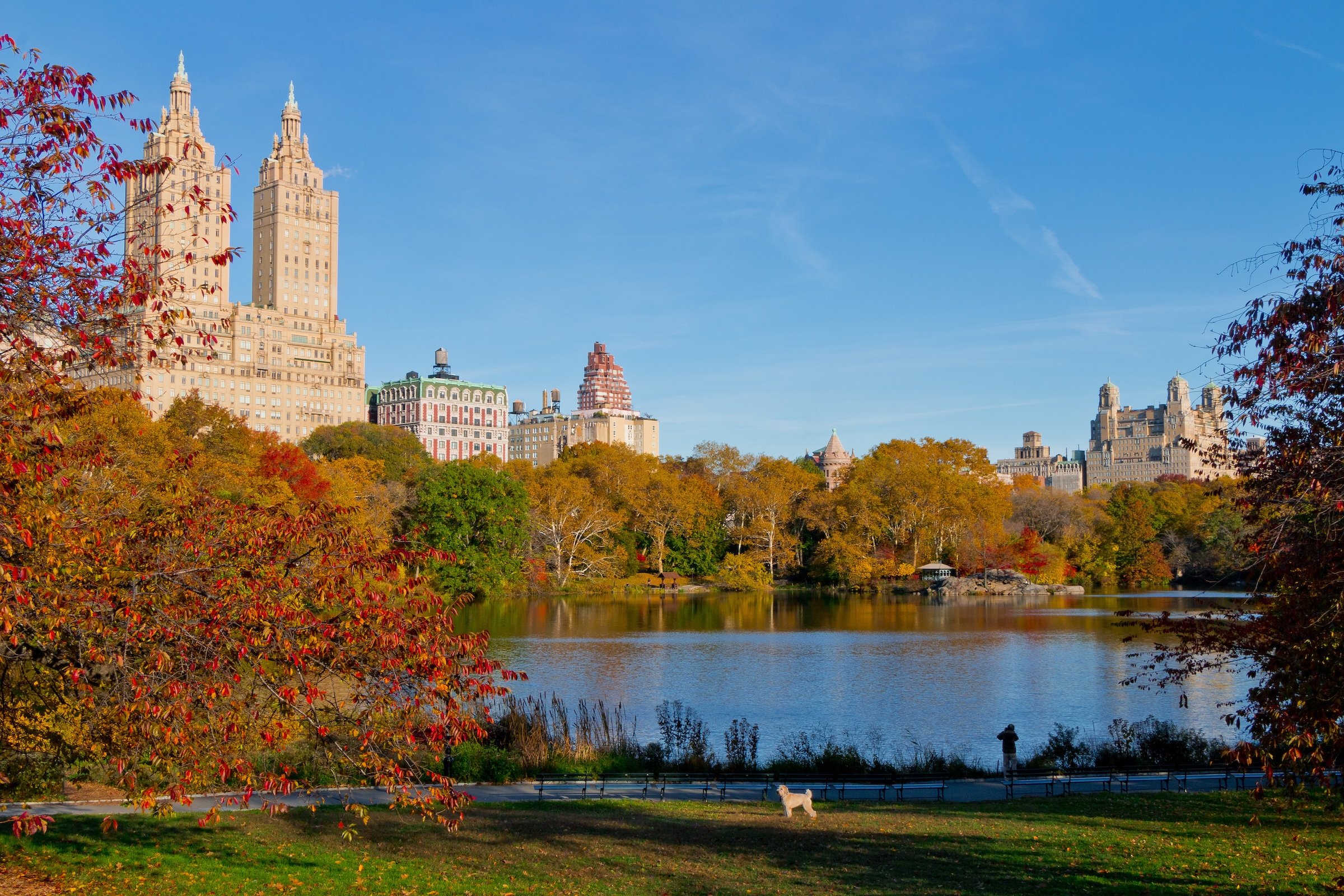
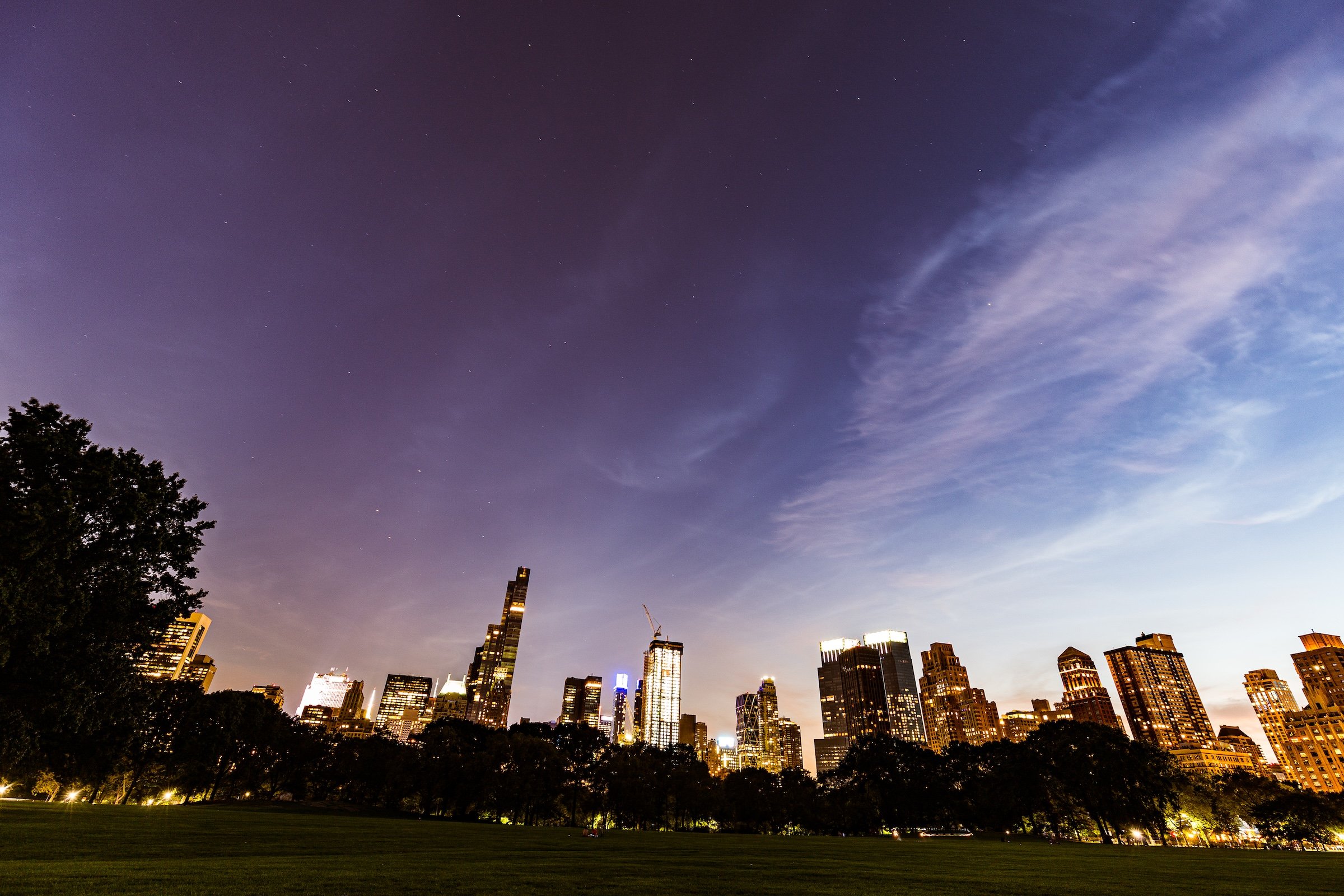
Water and horizon recur throughout its geography. The Lake, Reservoir, ponds, fountains, and seasonal pools of light create places of reflection—sometimes literal, sometimes figurative—where the city appears fractured, softened, or enlarged. Beyond them, Manhattan’s towers remain present as a constant reminder that this cultivated landscape exists within, not apart from, one of the world’s densest cities.
Its visual language also changes dramatically with the seasons. Winter exposes branches, stone, and skyline; spring briefly turns the Park into blossom and color; summer fills its lawns and paths with activity; autumn intensifies the drama of canopy, water, and light. Central Park is designed to be revisited, and its identity is never fixed for long.
Through The Lens
Photographing Central Park means photographing a dialogue between nature and construction. The camera finds the Park’s deliberate artifice in bridges, arches, terraces, fountains, paths, and carefully framed views—but it also finds moments when that design seems to disappear beneath weather, foliage, water, or human activity. A stone arch becomes a threshold. A bare tree becomes a skyline frame. A meadow becomes a public stage.
The photographs move between intimate and panoramic scales. There are close encounters with sculpture, lampposts, roots, branches, rock, and water; there are also long views across open lawns, reservoirs, and lakes toward the changing skyline. Together, they reveal Central Park as a place of layered vantage points: a landscape built not simply to be looked at, but to direct how one looks.
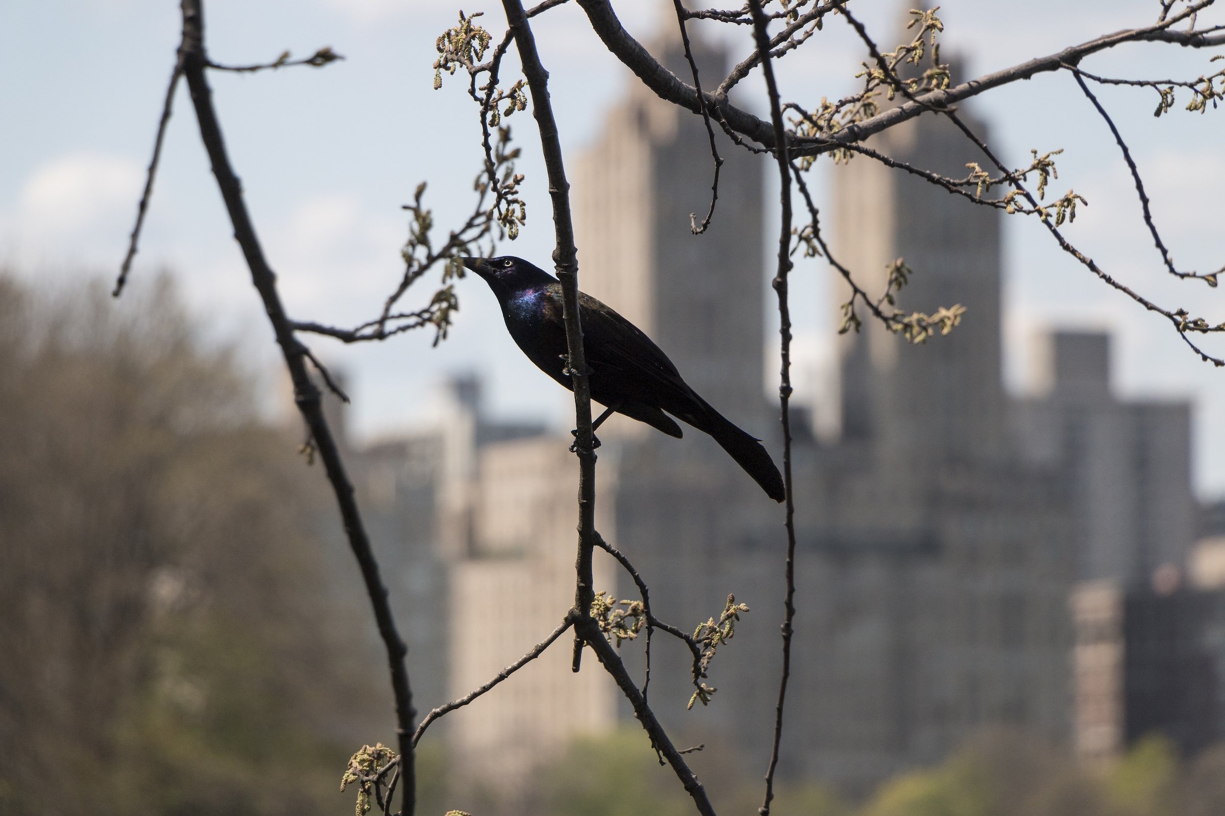
People remain part of that visual story. Runners, walkers, picnickers, visitors, performers, couples, children, and solitary figures animate the Park without ever fully overwhelming it. Their presence makes clear that Central Park is not an urban backdrop or preserved monument. It is a lived landscape—continually reinterpreted by the people who enter it.
If you visit Central Park, these ideas can help inspire your own photography.
Central Park: The Seasons
Central Park Photo Gallery
Central Park Field Notes
-
These photographs span excursions to Central Park from 2011 through 2026. Across those years, the Park has appeared in snow, rain, spring bloom, summer brightness, autumn color, dusk, and hard midday light. The earliest images often follow instinct: a striking skyline, a sculptural fountain, a sudden reflection, a bridge glimpsed through trees. Over time, those encounters began to form a larger understanding of the Park as a place with its own internal geography.
Repeated visits made its distinctions clearer. Sheep Meadow and the Great Lawn do not offer the same kind of openness. The Lake, Reservoir, Harlem Meer, and the Pool each hold water differently. The Ramble, North Woods, and Ravine create entirely different experiences of concealment, elevation, and movement than the terraces and promenades farther south. What first appeared to be one great park gradually revealed itself as a connected collection of landscapes, neighborhoods, systems, and memories.
This project grows from that realization. Central Park is familiar to millions of people, yet it is easy to know only fragments of it: a favorite lawn, a route through the Ramble, a landmark seen on the way to somewhere else. These field notes document a longer process of return—walking, observing, photographing, and learning to see the Park not as a single destination, but as a continually changing city within the city.